Scandinavia.TMO2003050
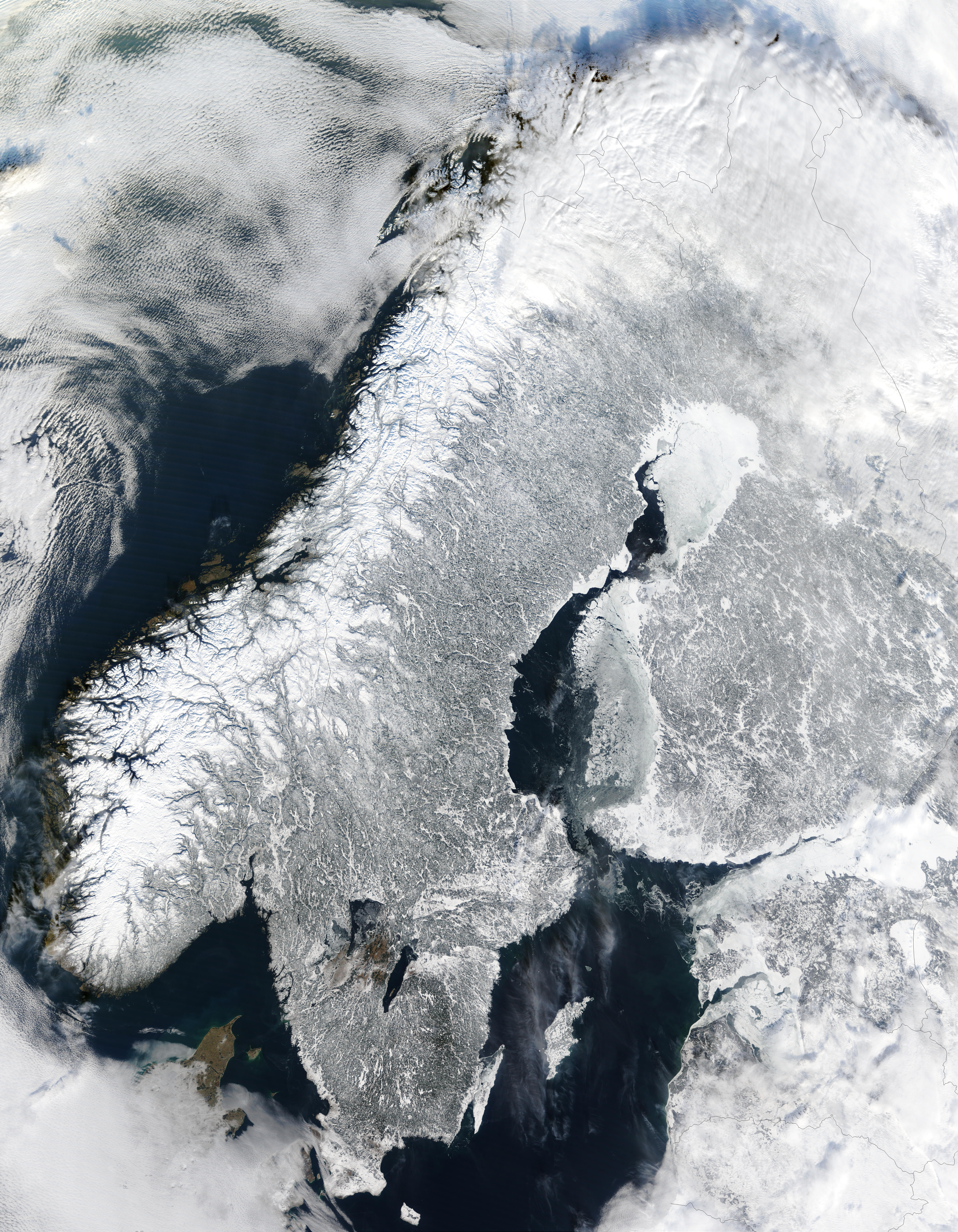
The Moderate Resolution Imaging Spectroradiometer (MODIS) instrument aboard NASA’s Terra satellite captured the above image of the Scandinavian Peninsula on February 19, 2003.
With a landscape largely shaped by glaciers over the last ice age, the Scandinavian Peninsula is as picturesque in the winter as it is cold. Along the left side of the peninsula, one can see the jagged inlets, known as fjords, lining Norway’s coast. Many of these fjords are well over 2,000 feet (610 meters) deep and were carved out by extremely heavy, thick glaciers that formed during the last ice age. The glaciers ran off the mountains and scoured troughs into Norway’s coastline with depths that reached well below sea level. When the glaciers melted, the seawater rushed into these deep troughs to form the fjords. The deepest fjord on Norway’s coast, known as Sogn Fjord, lies in southwest Norway and is 4,291 feet (1,308 m) deep.


Relevante Bilder


_02.jpg)
_edited.jpg)
.svg)


.svg)

.jpg)


.svg)
.svg)


.svg)
.jpg)

.jpg)

Relevante Artikel
SkandinavienSkandinavien ist ein Teil Nordeuropas. Je nach Definitionsweise umfasst er unterschiedliche Länder, darunter in jedem Fall Norwegen und Schweden auf der Skandinavischen Halbinsel, daneben im Regelfall auch Dänemark und bisweilen auch Finnland. .. weiterlesen
Skandinavische HalbinselDie Skandinavische Halbinsel ist eine Halbinsel Europas, die von Schonen im Süden bis zum Nordkap im Norden reicht. Auf der Skandinavischen Halbinsel befinden sich Norwegen und Schweden und der Großteil von Lappland im nördlichen Finnland. Das Skandinavische Gebirge definiert in der Regel die Grenze zwischen Norwegen und Schweden. Eine Abgrenzung Skandinaviens zur Halbinsel Kola und die Grenze innerhalb von Finnland muss willkürlich gezogen werden. .. weiterlesen
SchwedenDas Königreich Schweden ist eine parlamentarische Monarchie in Skandinavien. Das Staatsgebiet umfasst den östlichen Teil der Skandinavischen Halbinsel und die Inseln Gotland und Öland. Schweden ist Mitglied des Nordischen Rates, seit 1995 der Europäischen Union und seit 2024 der NATO. Hauptstadt sowie bevölkerungsreichste schwedische Stadt ist Stockholm. .. weiterlesen
NordeuropaNordeuropa ist ein zusammenfassender Begriff für alle nördlich gelegenen Länder Europas. .. weiterlesen