Satelite image of Malta
The many ancient monuments and remains on Malta attest to the great age of its civilization. Remains from Stone Age and Bronze Age peoples have been found in subterranean burial chambers. The islands became a Phoenician colony about 1000 B.C. They were later occupied by the Greeks, who called the colony Melita, and later the islands passed successively into the possession of Carthage and Rome. The islands were occupied by Arabs in 870 A.D. A Norman army conquered the Maltese Arabs in 1090, and Malta was later made a feudal fief of the kingdom of Sicily. In 1530 Holy Roman Emperor Charles V granted Malta to the Knights of Saint John of Jerusalem, who ruled the islands until the 19th century. In 1798 Napoleon invaded and occupied the islands during his Egyptian campaign. Unwilling to be ruled by France, the Maltese appealed to Britain, and in 1799 British naval officer Horatio Nelson besieged Valletta and compelled the withdrawal of the French. In 1814 Malta became part of the British Empire as a crown colony.
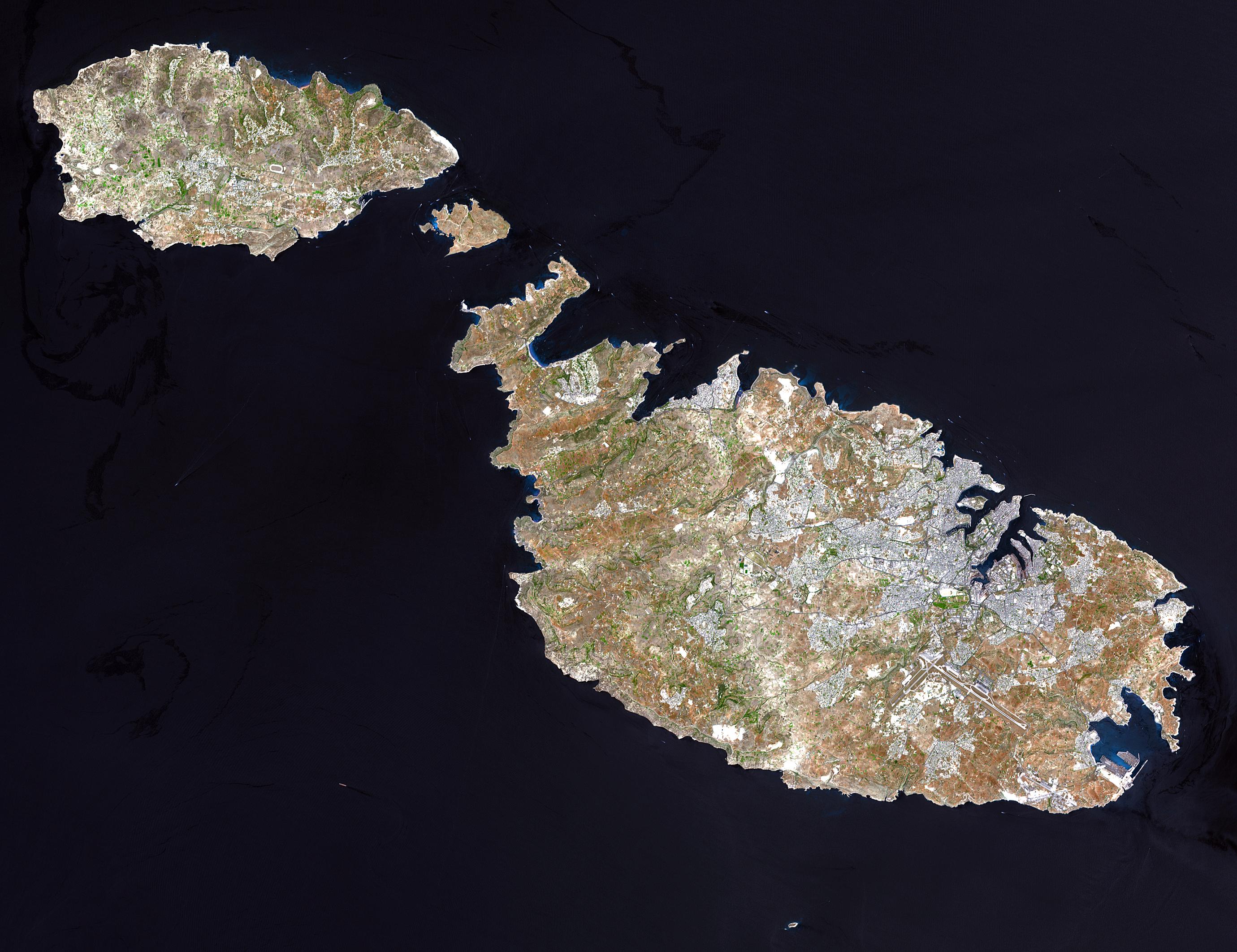
This natural-color image was acquired on July 29, 2001, by the Advanced Spaceborne Thermal Emission and Reflection Radiometer (ASTER) aboard NASA’s Terra satellite.
Image courtesy NASA/GSFC/MITI/ERSDAC/JAROS, and U.S./Japan ASTER Science Teamhttp://earthobservatory.nasa.gov/Newsroom/NewImages/images.php3?img_id=16706 NASA]
| Diese Datei ist gemeinfrei (public domain), da sie von der NASA erstellt worden ist. Die NASA-Urheberrechtsrichtlinie besagt, dass „NASA-Material nicht durch Urheberrecht geschützt ist, wenn es nicht anders angegeben ist“. (NASA-Urheberrechtsrichtlinie-Seite oder JPL Image Use Policy). | ||
 |
Warnung:
|


Relevante Bilder


.jpg)

.jpg)


_-_001.jpg)


_at_Gamla_Nature_Reserve.jpg)


.svg)

%2c_2010_North_Weald_bus_rally_(2).jpg)


Relevante Artikel
Flora und Vegetation der maltesischen InselnDie Flora und Vegetation der maltesischen Inseln zeichnet sich durch ihren typisch mediterranen Charakter aus. Sie steht insbesondere der Flora und Vegetation des nur rund 100 Kilometer entfernten Siziliens nahe, ist aber zusätzlich von der nordafrikanischen Pflanzenwelt beeinflusst. .. weiterlesen
MaltaMalta ist ein südeuropäischer Inselstaat im Mittelmeer zwischen Tunesien und Italien. .. weiterlesen
31. MärzDer 31. März ist der 90. Tag des gregorianischen Kalenders, somit verbleiben 275 Tage bis zum Jahresende. .. weiterlesen