PlanoMontevideoSitioGrande
Autor/Urheber:
Autor/-in unbekannt
Shortlink:
Quelle:
Größe:
924 x 657 Pixel (150433 Bytes)
Beschreibung:
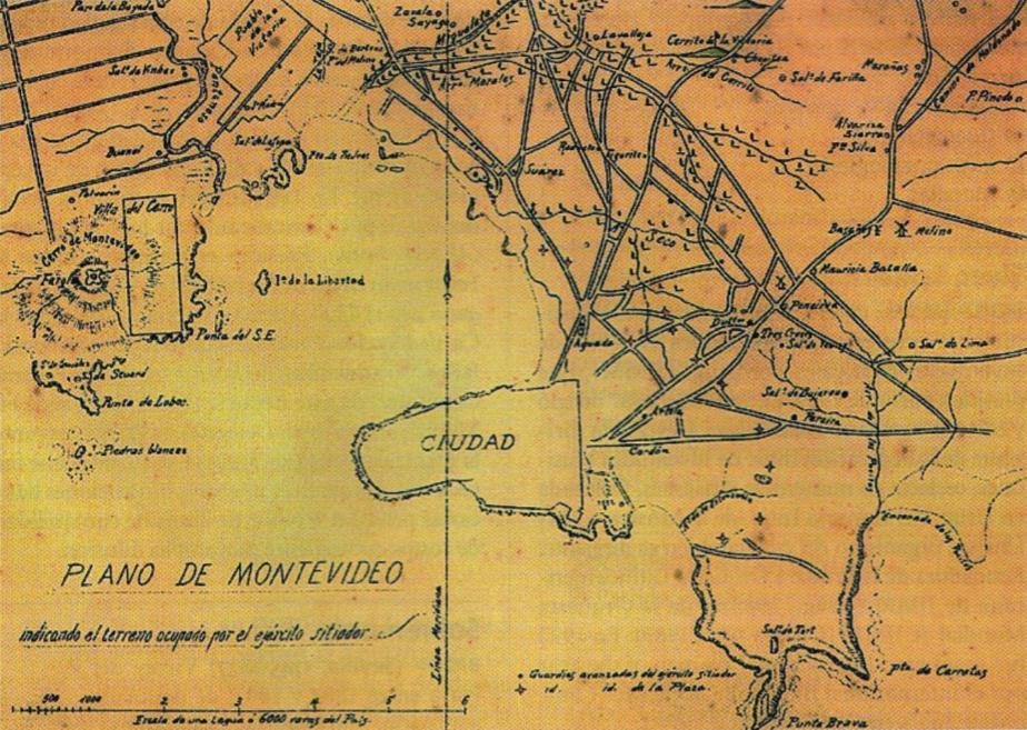
Former map of Montevideo (Uruguay) and surrounding towns (now converted into neighborhoods of the city), developed during the called Guerra Grande (Great War, 1843 - 1851), where the demarcation area occupied by the siege army of Montevideo.
Lizenz:
Public domain
Credit:
Digitalizado del libro Gran Enciclopedia del Uruguay
Bild teilen:


Relevante Bilder


.jpg)


.JPG)


.jpg)


.jpg)

.svg)


Relevante Artikel
MontevideoMontevideo [mɔnteviˈdeːo, span. mɔnteβiˈðeo] ist die Hauptstadt und Primatstadt Uruguays. Die am Mündungstrichter des Río de la Plata liegende Metropole hat rund 1,3 Mio. Einwohner und ist das wirtschaftliche, administrative und kulturelle Zentrum des Landes. .. weiterlesen