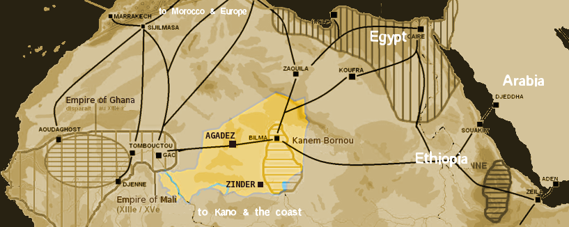
Niger saharan medieval trade routes
Autor/Urheber:
Shortlink:
Quelle:
Größe:
817 x 326 Pixel (269098 Bytes)
Beschreibung:
Map showing the main trans-Saharan caravan routes circa 1400. Also shown are the Ghana Empire (until the 13th century) and 13th – 15th century Mali Empire. Note the western route running from Djenné via Timbuktu to Sijilmassa. Present day Niger in yellow.
Lizenz:
Public domain
Credit:
self-made using The Gimp and Image:Africa historical traite.JPG
Bild teilen:


Relevante Bilder


Relevante Artikel
NordafrikaNordafrika ist der nördliche Teil Afrikas und wie andere multinationale geographische Gebiete dieses Kontinents geographisch nicht klar abzugrenzen. Einige Staaten werden wahlweise Nordafrika, Westafrika oder Subsahara-Afrika zugeordnet. .. weiterlesen