Ngorongoro topo
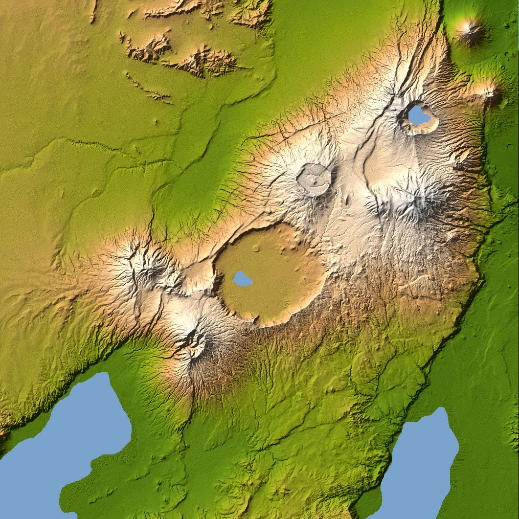
Ngorongoro’s caldera is 22.5 kilometers (14 miles) across at its widest point and is 610 meters (2,000 feet) deep. Its floor is very level, holding a lake fed by streams running down the caldera wall. It is part of the Ngorongoro Conservation Area and is home to over 75,000 animals. The lakes south of the crater are Lake Eyasi and Lake Manyara, also part of the conservation area.
Orientation: North toward the top, Mercator projection
Image Data: shaded and colored SRTM elevation model. The shade image was derived by computing topographic slope in the northwest-southeast direction, so that northwest slopes appear bright and southeast slopes appear dark. Color coding is directly related to topographic height, with green at the lower elevations, rising through yellow and tan, to white at the highest elevations.
Date Acquired: February 2000


Relevante Bilder


Relevante Artikel
NgorongoroNgorongoro ist ein Einbruchkrater in Tansania am Rande der Serengeti. Er entstand, als an dieser Stelle ein Vulkanberg in sich zusammenbrach. Der Kraterboden liegt auf etwa 1700 m und die Seitenwände sind zwischen 400 und 600 Meter hoch, so dass die Kraterkante auf etwa 2300 m liegt. Der Durchmesser des Kraters beträgt zwischen 17 und 21 Kilometer. Insgesamt hat der Krater eine Fläche von 26.400 Hektar. .. weiterlesen