Modern and Complete Map of the Entire World
Relevante Bilder
Relevante Artikel
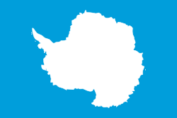
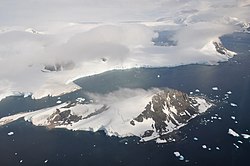
AntarktikaAntarktika ist der Südkontinent der Erde, auf dem auch der Südpol selbst liegt. Es liegt inmitten der Antarktis, mit der er umgangssprachlich oft identifiziert wird. Weitere Bezeichnungen sind Südkontinent und antarktischer Erdteil. Antarktika hat eine Fläche von etwa 14 Millionen Quadratkilometern und ist nahezu vollständig vom antarktischen Eisschild bedeckt. Geografisch unterscheidet man die Regionen Westantarktika und Ostantarktika. .. weiterlesen
AntarktisDie Antarktis umfasst die um den Südpol gelegenen Land- und Meeresgebiete, also im Groben den Kontinent Antarktika und den Südlichen Ozean. Sie ist damit eines der beiden Polargebiete. Als geographisch-astronomische Zone wird sie durch den südlichen Polarkreis begrenzt und reicht somit vom Südpol bis 66° 33′ südlicher Breite. Als ozeanografische Grenze gilt die antarktische Konvergenz bei etwa 50° südlicher Breite, wo das kalte antarktische unter das wärmere subtropische Oberflächenwasser absinkt. Die Zone zwischen 50° Süd und dem Polarkreis wird auch als subantarktisch bezeichnet. Seit der Definition des Südlichen Ozeans mit dem 60. Breitengrad (2000) beginnt sich diese Grenze auch auf den Antarktisbegriff auszuwirken. Die Subantarktis bildet jeweils die Südzone der umgebenden Meeresgebiete Südatlantik, Südpazifik und Südlicher Indischer Ozean. .. weiterlesen


