Irrigation in the Heart of the Sahara
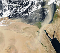
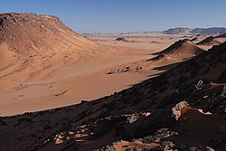
Although it is now the largest desert on Earth, during the last ice age the Sahara was a savannah with a climate similar to that of present-day Kenya and Tanzania. The annual rainfall was much greater than it is now, creating many rivers and lakes that are now hidden under shifting sands or exposed as barren salt flats. Over several hundred thousand years the rains also filled a series of vast underground aquifers. Modern African nations are now mining this fossil water to support irrigated farming projects. The above pair of images shows a small settlement just north of the border between Egypt and Sudan. The dark circles—each about a kilometer across—indicate central-pivot irrigation. A well drilled in the center of each circle supplies water to a rotating series of sprinklers. Rainfall in this area of the Sahara is only a few centimeters a year, so the aquifers will take thousands of years (or longer) to recharge, making the water a non-renewable resource. Although no one knows how much water is beneath the Sahara, hydrologists estimate that it will only be economical to pump water for fifty years or so. On the other hand, alternative technologies for providing fresh water in this arid region—primarily desalinization—are too expensive for widespread use. Sudan, Libya, Chad, Tunisia, Morocco and Algeria are some of the other Saharan nations irrigating with fossil water, but the practice is not limited to Africa. In the southern plains of the United States, the Ogallala aquifer is being drained faster than it can be replenished. These true-color images were acquired by the Enhanced Thematic Mapper plus (ETM+) aboard NASA’s Landsat 7 satellite. The Landsat satellites enable scientists to monitor land use and land cover change dating back to 1972. Landsat 7 is designed to last until at least 2004, and follow-on missions are currently being planned.
Relevante Bilder


Relevante Artikel
BewässerungBewässerung ist die Versorgung des Kulturlandes mit Wasser, um das Wachstum von Pflanzen zu fördern und fehlenden Regen zu ersetzen. Dabei wird vor allem in ariden Regionen zwischen den Wendekreisen bewässert, um den Sonnenreichtum und die hohen Temperaturen auszunutzen. Aber auch in humiden Regionen wird für sehr wasserbedürftige Pflanzen – wie Reis – oder für die Überbrückung saisonaler Trockenphasen bewässert. .. weiterlesen
Libysche WüsteDie Libysche Wüste, arabisch الصحراء الليبية, DMG aṣ-ṣaḥrāʾ al-lībiya, ist eine Wüste in Libyen, in Ägypten und im Sudan. In Ägypten wird sie wegen der historischen Animositäten gegen Libyer und Libyen auch „Westliche Wüste“ genannt, obwohl man seit dem Altertum, unter anderem auch in Mesopotamien, alle Gebiete westlich des Nils Libyen nannte und deren Bewohner Libyer. .. weiterlesen
Fossiles WasserFossiles Wasser ist Wasser in tiefen Gesteinskörpern, das seit der Prähistorie – teils auch deutlich länger – keinen Kontakt mehr mit der Erdatmosphäre oder Oberflächengewässern hatte. Für ein genaues Mindestalter gibt es keine einheitliche Festlegung, nicht selten wird ein frühholozänes Alter, das heißt 10.000 bis 12.000 Jahre, als Richtwert genannt. Die Bezeichnung fossiles Wasser wird vorwiegend für entsprechend alte meteorische (paläometeorische) Wässer, das heißt vor mindestens mehreren Jahrtausenden versickerte Niederschlagswässer, verwendet. Die Grundwasserleiter dieser auch tiefe Grundwässer genannten Wässer liegen im Bereich von mindestens einigen hundert Metern unterhalb des Niveaus der Oberflächengewässer oder sind anderweitig mehr oder weniger vollständig vom Zufluss von der und Abfluss zur Erdoberfläche isoliert. Aber auch tief versenkte, synsedimentäre Porenwässer urzeitlicher Oberflächengewässer, sogenannte konnate Wässer, werden als fossiles Wasser bezeichnet. .. weiterlesen
