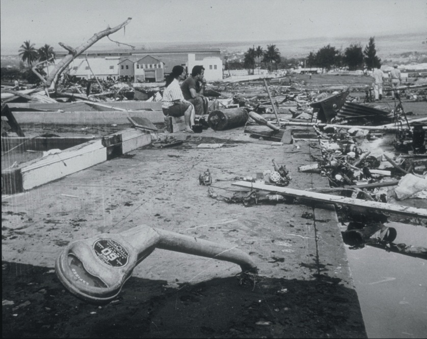
Hilo after Tsunami 1960


Autor/Urheber:
US Navy
Größe:
838 x 665 Pixel (189848 Bytes)
Beschreibung:
Tsunami Generated by Earthquake of May 22, 1960, Coast of Chile The Waiakea area of Hilo, Hawaii, 10,000 km from the generating area. Parking meters were bent by the force of the debris-filled waves. Note the scattered debris and the gutted foundation. This tsunami, generated by the earthquake off the coast of central Chile, affected the entire Pacific Basin. One of the most seriously affected areas was Hilo, Hawaii, where 61 deaths and $24 million in damage occurred. In the area of maximum destruction, only buildings of reinforced concrete or structural steel, and a few others sheltered by these buildings, remained standing -- and even these were generally gutted. Frame buildings either were crushed or floated early to the limits of flooding. Photo credit: U.S. Navy
Lizenz:
Public domain
Bild teilen:
Facebook   Twitter   Pinterest   WhatsApp   Telegram   E-Mail
Weitere Informationen zur Lizenz des Bildes finden Sie hier. Letzte Aktualisierung: Sun, 18 Feb 2024 03:17:28 GMT

Relevante Bilder


Relevante Artikel

Erdbeben von Valdivia 1960

Das Erdbeben von Valdivia am 22. Mai 1960, auch Großes-Chile-Erdbeben genannt, war ein Megathrust-Erdbeben mit der weltweit größten jemals aufgezeichneten Magnitude und das schwerste Erdbeben des 20. Jahrhunderts. Um 15:11 Uhr Ortszeit (19:11 UT) erreichte das Beben auf der Momenten-Magnituden-Skala einen Wert von Mw 9,5. Die topographische Gestalt großer Gebiete des Kleinen Südens Chiles wurde verändert, besonders betroffen war das Gebiet um die Provinzhauptstadt Valdivia. .. weiterlesen

Hilo

Hilo ist mit rund 44.000 Einwohnern die größte Stadt auf Big Island im US-Bundesstaat Hawaii. Sie ist auch Hauptstadt des Hawaii County und damit der gesamten Insel. Hilo liegt an der Hilo Bay genannten Bucht im Nordosten der Insel. .. weiterlesen