GNIS map Lake vs. Pond (4135570896)
.jpg?uselang=de)
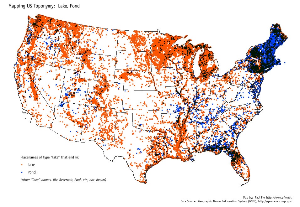
GNIS map Lake vs. Pond. The USGS GNIS placename database was used to make this map. Any body of water (GNIS's "lake" feature class) whose name ends in "Lake" gets an orange dot, and any whose name ends in "Pond" gets a blue dot. The map shows a tendency to use "pond" instead of "lake" in the New England region, with scattered uses of "pond" elsewhere, such as northern Florida. Source data, USGS GNIS placename database and ESRI's state boundary data.
Software, ESRI ArcGIS.


Relevante Bilder
.jpg)
.jpg)
.jpg)
Relevante Artikel
Geographic Names Information SystemGeographic Names Information System (GNIS) ist eine Datenbank, die Namen und Lageinformationen von nahezu zwei Millionen geographischen Objekten in den Vereinigten Staaten und den abhängigen Territorien enthält. GNIS wurde vom United States Geological Survey in Zusammenarbeit mit dem United States Board on Geographic Names (BGN) aufgebaut, um die Standardisierung der Namensgebung geographischer Objekte voranzutreiben. .. weiterlesen