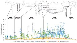
Flooding from Tsunami near Sendai, Japan2
The Moderate Resolution Imaging Spectroradiometer (MODIS) on NASA’s Aqua satellite took the top image, while the MODIS sensor on NASA’s Terra satellite took the lower image. Both images were made with infrared and visible light to highlight the presence of water on the ground. Plant-covered land is bright green, bare earth is tan-pink, and snow is blue. The city of Sendai is brown.
At this level of detail, the flooding along the coastline is the most obvious sign of the destructive earthquake and tsunami that struck Japan on March 11. A bright orange-red spot near the city of Sendai is the thermal signature from a fire, also likely caused by the earthquake. The photo-like true-color version of the image shows a plume of black smoke extending east over the ocean.
The images are from the MODIS Rapid Response System, which is producing twice-daily images of Japan in response to the disaster.
NASA images courtesy the MODIS Rapid Response Team at NASA GSFC. Caption by Holli Riebeek.
Instrument: Aqua - MODIS
The two original NASA images have been combined and cropped.Relevante Bilder
Relevante Artikel
Tōhoku-Erdbeben 2011Das Tōhoku-Erdbeben 2011 war ein großes Seebeben vor der Sanriku-Küste der japanischen Region Tōhoku. Es ereignete sich am 11. März 2011 um 14:46:23 Uhr Ortszeit. Das Epizentrum lag vor der Küste der Präfektur Miyagi etwa 370 Kilometer nordöstlich von Tokio und 130 km östlich von Sendai und löste Tsunami-Flutwellen aus, die eine Fläche von über 500 km² der japanischen Pazifikküste überfluteten. In Bezug auf die Ausdehnung der betroffenen Fläche handelt es sich um das größte bekannte Tsunami-Ereignis der japanischen Geschichte. Von den rund 600.000 durch den Tsunami betroffenen Einwohnern wurden etwa 3,5 % getötet. .. weiterlesen
Chronologie der Katastrophe in Japan von 2011Die Chronologie der Katastrophe in Japan von 2011 soll einen zeitlichen Überblick über die Ereignisse nach dem Tōhoku-Erdbeben 2011 am 11. März im Nordosten Japans geben. Neben den Folgen des in Japan historisch größten bekannten Erdbebens samt vielen Nachbeben, der unmittelbaren Tsunami-Flutwellen und mehreren schwerwiegenden Reaktorunfällen wird außerdem der Ablauf der Hilfsaktionen erfasst. .. weiterlesen


