Fürstentum Regensburg 1807
Autor/Urheber:
Geographisches Institut, Weimar 1807
Shortlink:
Quelle:
Größe:
792 x 803 Pixel (521547 Bytes)
Beschreibung:
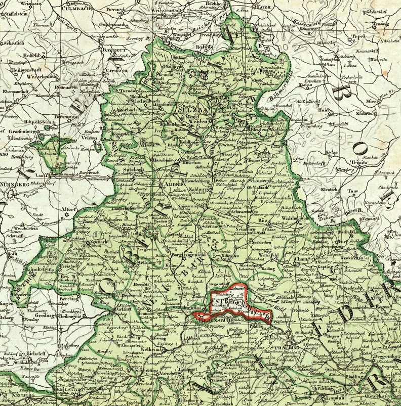
Detail of a map from 1807 showing the Principality of Regensburg (German: Fürstentum Regensburg) enclaved within the Kingdom of Bavaria (in green).
The ephemeral principality (1803 to 1810) had been formed with the territories of the former Prince-Bishopric of Regensburg and Free Imperial City of Regensburg. Cropped from a map of the Kingdom of Bavaria published in 1807 by the Geographical Institute of Weimar.
The ephemeral principality (1803 to 1810) had been formed with the territories of the former Prince-Bishopric of Regensburg and Free Imperial City of Regensburg. Cropped from a map of the Kingdom of Bavaria published in 1807 by the Geographical Institute of Weimar.
Lizenz:
Public domain
Credit:
Reinhold Berg (antique maps for sale)
Bild teilen:


Relevante Bilder
.JPG)
Relevante Artikel
Fürstentum RegensburgDas Fürstentum Regensburg entstand durch den Reichsdeputationshauptschluss 1803 und war bis 1810 eines der Territorien des Kurerzkanzlers, seit 1806 Fürstprimas innerhalb des Rheinbundes. .. weiterlesen