CairoIL from space annotated
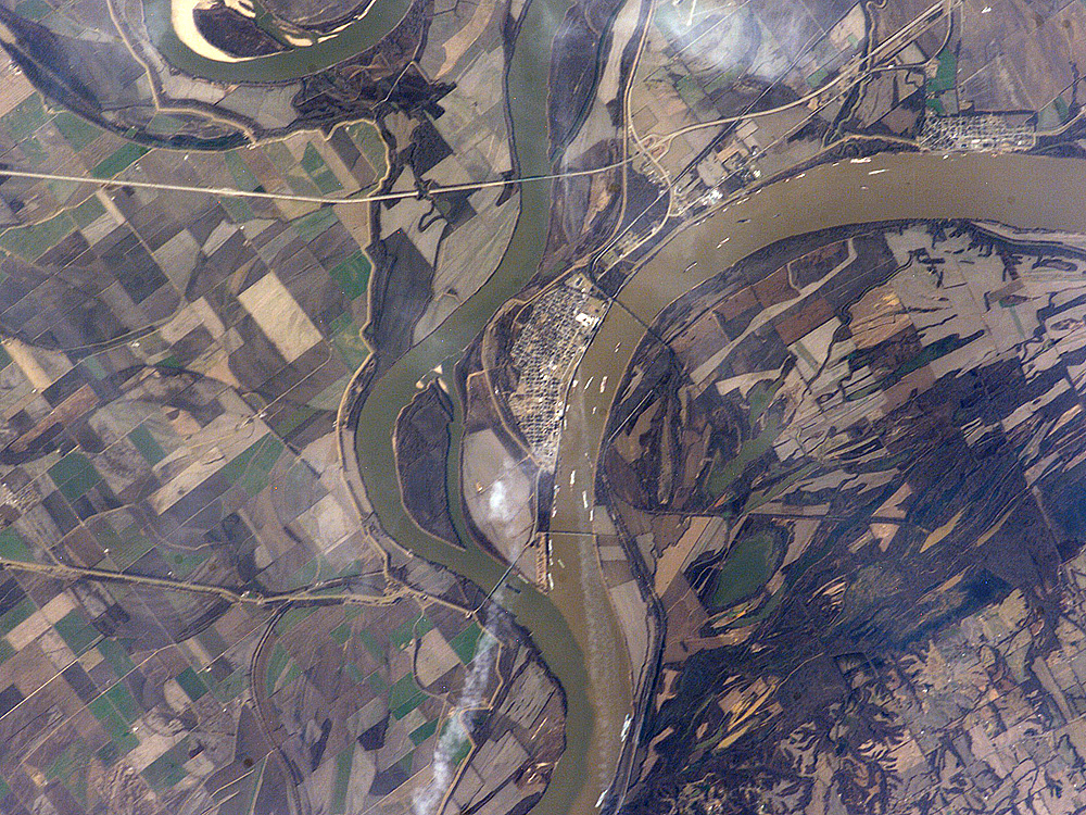
Astronaut photo of the confluence of the Mississippi and Ohio Rivers at Cairo, Illinois.
| Identification | |
|---|---|
| Mission | ISS012 (Expedition 12) |
| Roll | E |
| Frame | 15035 |
| Country or Geographic Name | USA-ILLINOIS |
| Features | CAIRO, MISSISSIPPI R., OHIO R. |
| Center Point Latitude | 37.0° N |
| Center Point Longitude | -89.2° E |
| Camera | |
| Camera Tilt | 17° |
| Camera Focal Length | 400 mm |
| Camera | Kodak DCS760C Electronic Still Camera |
| Film | 3060 x 2036 pixel CCD, RGBG array. |
| Quality | |
| Percentage of Cloud Cover | 0-10% |
| Nadir What is Nadir? | |
| Date | 2006-01-12 |
| Time | 18:38:03 |
| Nadir Point Latitude | 37.2° N |
| Nadir Point Longitude | -88.3° E |
| Nadir to Photo Center Direction | West |
| Sun Azimuth | 190° |
| Spacecraft Altitude | 185 nautical miles (343 km) |
| Sun Elevation Angle | 31° |
| Orbit Number | 867 |
| Original image caption | |
| The Ohio River becomes a tributary of the Mississippi River directly south of Cairo, Illinois, a small city on the spit of land where the rivers converge (at center of this astronaut photograph). Brown, sediment-laden water flowing generally northeast to south from the Ohio River is distinct from the green and relatively sediment-poor water of the Mississippi River (flowing northwest to south). The color of the rivers in this image is reversed from the usual condition of a green Ohio and a brown Mississippi. This suggests that the very high rainfall in December 2005 over the Appalachians and the northeastern United States has led to greater-than-normal amounts of sediment in the rivers and streams of the Ohio River watershed. The distinct boundary between the two river’s waters indicates that little to no mixing occurs even 5-6 kilometers (3-4 miles) downstream.
| |
Relevante Bilder
Relevante Artikel
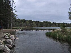
Mississippi RiverDer Mississippi [ˌmɪsɪˈsɪpɪ] ist ein 3778 Kilometer langer Strom in den Vereinigten Staaten. Er entspringt dem Lake Itasca im nördlichen Minnesota und mündet rund 160 Kilometer südlich von New Orleans in den Golf von Mexiko. .. weiterlesen
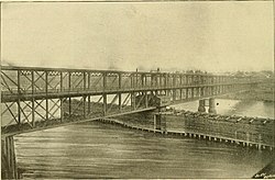
George S. MorisonGeorge Shattuck Morison war ein US-amerikanischer Jurist, Eisenbahnmanager und Bauingenieur. Nach dem Jurastudium und kurzer Tätigkeit als Anwalt strebte Morison eine Karriere als Bauingenieur an. Ohne formelle Ausbildung auf dem Gebiet sammelte er unter Octave Chanute erste Erfahrungen und betrieb intensives Selbststudium, das er über seine gesamte berufliche Laufbahn aufrechterhielt. Morison widmete sich vorrangig dem Brückenbau zur Zeit der expandierenden Eisenbahngesellschaften in Nordamerika Ende des 19. Jahrhunderts und wurde einer der führenden Experten auf diesem Gebiet. Er realisierte über zwanzig große Eisenbahnbrücken unter anderem über den Missouri, Mississippi und Ohio, darunter mit der über drei Kilometer langen Cairo Rail Bridge (1890) die damals längste Stahl-Fachwerkbrücke der Welt und mit der Frisco Bridge (1892) die Auslegerbrücke mit der damals längsten Spannweite in Nordamerika. Zudem war Morison 1895 Präsident der American Society of Civil Engineers und Mitglied der Isthmian Canal Commission von 1899, die eine Route für einen Schifffahrtskanal in Mittelamerika erarbeitete und sich auf Initiative von Morison für den späteren Panamakanal entschied. .. weiterlesen
Cairo (Illinois)Cairo ist eine Stadt im Alexander County im US-Bundesstaat Illinois und dessen County Seat. Das U.S. Census Bureau hat bei der Volkszählung 2020 eine Einwohnerzahl von 1.733 ermittelt. .. weiterlesen
Ohio RiverDer Ohio ist der größte linke Nebenfluss des Mississippi. Er entsteht durch die Vereinigung der beiden Flüsse Allegheny (Hauptquellfluss) und Monongahela in Pittsburgh. Nahe der Stadt Cairo mündet der Ohio in den bis dahin sogenannten Oberen Mississippi (Upper Mississippi). Der Ohio ist auf seiner gesamten Länge von 1579 km schiffbar. .. weiterlesen
