Liste der Countys in Wisconsin
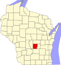
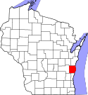
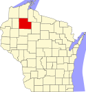
Der US-amerikanische Bundesstaat Wisconsin ist in 72 Countys eingeteilt. Die offizielle Abkürzung von Wisconsin lautet WI, der FIPS-Code ist 55. Der FIPS-Code jedes einzelnen Countys beginnt also stets mit 55, an die die in der Tabelle für jedes County genannte dreistellige Zahl angehängt wird. Die in der Tabelle angegebenen Einwohnerzahlen basieren auf den Daten der Volkszählung im Jahr 2010. |
| County | FIPS-Code[1] | County Seat | Gründung | Ursprung | Namensherkunft | Einwohner 2010[2] | Fläche[3] | Karte |
|---|---|---|---|---|---|---|---|---|
| Adams | 001 | Friendship | 1848 | Portage County | John Quincy Adams (1767–1848), sechster Präsident der USA (1825–1829) | 20.875 | 1.678 km² |  |
| Ashland | 003 | Ashland | 1860 | Indianerland | Ashland, das erste Anwesen von Henry Clay in Kentucky | 16.157 | 2.704 km² |  |
| Barron | 005 | Barron | 1859 | Polk County | Henry D. Barron, Richter und später Politiker in Wisconsin | 45.870 | 2.235 km² |  |
| Bayfield | 007 | Washburn | 1845 | Ashland County | Henry Wolsey Bayfield, britischer Marineoffizier, vermaß das Gebiet der Großen Seen | 15.014 | 3.823 km² |  |
| Brown | 009 | Green Bay | 1818 | Indianerland | Jacob Brown (1775–1828), amerikanischer Offizier im Britisch-Amerikanischen Krieg von 1812, seit 1821 Oberbefehlshaber des Heeres | 248.007 | 1.370 km² |  |
| Buffalo | 011 | Alma | 1853 | Trempealeau County | Buffalo River, durchfließt das County | 13.587 | 1.772 km² |  |
| Burnett | 013 | Town of Meenon | 1856 | Polk County | Thomas P. Burnett, Politiker im Wisconsin-Territorium | 15.457 | 2.129 km² |  |
| Calumet | 015 | Chilton | 1836 | Indianerland | Das französische Wort für Friedenspfeife | 48.971 | 829 km² |  |
| Chippewa | 017 | Chippewa Falls | 1845 | Crawford County | Indianerstamm der Anishinabe (auch Chippewa genannt) | 62.415 | 2.l616 km² |  |
| Clark | 019 | Neillsville | 1853 | Crawford County | George Rogers Clark (1752–1818), General im Amerikanischen Unabhängigkeitskrieg | 34.690 | 3.149 km² |  |
| Columbia | 021 | Portage | 1846 | Portage County | Christoph Kolumbus (1451–1506), Seefahrer und Entdecker | 56.833 | 2.005 km² |  |
| Crawford | 023 | Prairie du Chien | 1818 | Indianerland | William Harris Crawford (1772–1834), Senator von Georgia (1807–1813), Finanzminister (1816–1825) und Kriegsminister der USA (1815–1816) | 16.644 | 1.484 km² |  |
| Dane | 025 | Madison | 1836 | Indianerland | Nathan Dane (1752–1835), Abgeordneter des ersten Kontinentalkongresses 1785–1788 | 488.073 | 3.113 km² |  |
| Dodge | 027 | Juneau | 1836 | Indianerland | Henry Dodge (1782–1867), Gouverneur des Wisconsin-Territoriums (1836–1841 und 1845–1848) | 88.759 | 2.284 km² |  |
| Door | 029 | Sturgeon Bay | 1851 | Brown County | Nach der (frz. porte des la morts – deutsch.: Tor zum Tode) door of the dead genannten Wasserpassage | 27.785 | 1.251 km² |  |
| Douglas | 031 | Superior | 1854 | Indianerland | Stephen A. Douglas (1813–1861), Senator von Illinois (1847–1861) und 1860 Präsidentschaftskandidat gegen Abraham Lincoln | 44.159 | 3.390 km² |  |
| Dunn | 033 | Menomonie | 1854 | Chippewa County | Charles Dunn, Senator im Wisconsin-Territorium | 43.857 | 2.207 km² |  |
| Eau Claire | 035 | Eau Claire | 1856 | Chippewa County | Eau Claire, (französisch für klares Wasser) | 98.736 | 1.652 km² |  |
| Florence | 037 | Florence | 1882 | Marinette County und Oconto County | Florence Julst, die erste weiße Siedlerin in der Gegend | 4.423 | 1.264 km² |  |
| Fond du Lac | 039 | Fond du Lac | 1836 | Indianerland | Das französische Wort für "Grund des Sees" | 101.633 | 1.873 km² |  |
| Forest | 041 | Crandon | 1885 | Langlade County und Oconto County | Feldgehölze | 9.304 | 2.626 km² |  |
| Grant | 043 | Lancaster | 1836 | Indianerland | Ein Händler namens Grant | 51.208 | 2.973 km² |  |
| Green | 045 | Monroe | 1836 | Indianerland | Nathanael Greene (1742–1786), General im Amerikanischen Unabhängigkeitskrieg | 36.842 | 1.513 km² |  |
| Green Lake | 047 | Green Lake | 1858 | Marquette District | Green Lake, gelegen inmitten des County | 19.051 | 917 km² |  |
| Iowa | 049 | Dodgeville | 1829 | Indianerland | Indianerstamm der Iowa | 23.687 | 1.976 km² |  |
| Iron | 051 | Hurley | 1893 | Ashland County und Oneida County | Lokale Eisenerzvorkommen | 5.916 | 1.961 km² |  |
| Jackson | 053 | Black River Falls | 1853 | La Crosse County | Andrew Jackson (1767–1845), Präsident der USA (1829–1837) | 20.449 | 2.556 km² |  |
| Jefferson | 055 | Jefferson | 1836 | Milwaukee County | Thomas Jefferson (1743–1826), dritter Präsident der USA (1801–1809) | 83.686 | 1.443 km² |  |
| Juneau | 057 | Mauston | 1856 | Adams County | Solomon Laurent Juneau (1793–1856), Gründer des heutigen Milwaukee | 26.664 | 1.989 km² |  |
| Kenosha | 059 | Kenosha | 1850 | Racine County | Indianischer Ausdruck | 166.426 | 707 km² |  |
| Kewaunee | 061 | Kewaunee | 1852 | Manitowoc County | Indianischer Ausdruck | 20.574 | 888 km² |  |
| La Crosse | 063 | La Crosse | 1851 | Indianerland | Das auf indianische Wurzeln zurückgehende Ballspiel Lacrosse | 114.638 | 1.173 km² |  |
| Lafayette | 065 | Darlington | 1846 | Iowa County | Marquis de La Fayette (1757–1834), französischer General im Amerikanischen Unabhängigkeitskrieg | 16.836 | 1.642 km² |  |
| Langlade | 067 | Antigo | 1879 | Indianerland | Charles de Langlade (1729–1800), Pelzhändler mit französischen und indianischen Wurzeln | 19.977 | 2.261 km² |  |
| Lincoln | 069 | Merrill | 1874 | Marathon County | Abraham Lincoln (1809–1865), Präsident der USA 1861–1865 | 28.743 | 2.287 km² |  |
| Manitowoc | 071 | Manitowoc | 1836 | Indianerland | Munedoo-owk, Ojibwe-Wort für Stelle des guten Geistes | 81.442 | 1.533 km² |  |
| Marathon | 073 | Wausau | 1850 | Portage County | Marathon (Griechenland) | 134.063 | 4.002 km² |  |
| Marinette | 075 | Marinette | 1879 | Oconto | Marinette, ein reisender Posthalter | 41.749 | 3.631 km² |  |
| Marquette | 077 | Montello | 1836 | Marquette District | Jacques Marquette (1637–1675), französischer Jesuitenpater und Entdecker | 15.404 | 1.181 km² |  |
| Menominee | 079 | Keshena | 1861 | Reservation der Menominee | Indianerstamm der Menominee | 4.232 | 927 km² |  |
| Milwaukee | 079 | Milwaukee | 1835 | Indianerland | Mahnawaukee-Seepe, indianischer Ausdruck für Versammlungsplatz am Fluss | 947.735 | 627 km² |  |
| Monroe | 081 | Sparta | 1854 | La Crosse County | James Monroe (1758–1831), fünfter Präsident der USA 1817–1825 | 44.673 | 2.334 km² |  |
| Oconto | 083 | Oconto | 1851 | Indianerland | Indianische Siedlung am gleichnamigen Fluss, bedeutet etwa fischreiches (Gewässer) | 37.660 | 2.585 km² |  |
| Oneida | 085 | Rhinelander | 1885 | Lincoln County | Indianerstamm der Oneida | 35.998 | 2.914 km² |  |
| Outagamie | 087 | Appleton | 1851 | Brown County | Indianerstamm der Fox, auch Meskwaki oder Outagamie genannt | 176.695 | 1.658 km² |  |
| Ozaukee | 089 | Port Washington | 1853 | Milwaukee County | Das Ojibwe-Wort für den Indianerstamm der Sauk | 86.395 | 601 km² |  |
| Pepin | 091 | Durand | 1858 | Dunn County | Die Entdecker Pierre und Jean Pepin du Chardonnets | 7.469 | 601 km² |  |
| Pierce | 093 | Ellsworth | 1853 | Saint Croix County | Franklin Pierce (1804–1869), 14. Präsident der USA 1853–1857 | 41.019 | 1.492 km² |  |
| Polk | 095 | Balsam Lake | 1853 | Saint Croix County | James K. Polk (1795–1849), elfter Präsident der USA (1845–1849) | 44.205 | 2.375 km² |  |
| Portage | 097 | Stevens Point | 1836 | Indianerland | Passage zwischen dem Fox und dem Wisconsin River | 70.019 | 2.088 km² |  |
| Price | 099 | Phillips | 1879 | Chippewa County und Lincoln County | William T. Price, Präsident des Senats von Wisconsin (1879) | 14.159 | 3.245 km² |  |
| Racine | 101 | Racine | 1836 | Indianerland | Das französische Wort Racine (dt.: Wurzel, en: root), benannt nach dem Root River, der das County durchfließt | 195.408 | 862 km² |  |
| Richland | 103 | Richland Center | 1842 | Iowa County | (Ertrag)reicher Boden | 18.021 | 1.518 km² |  |
| Rock | 105 | Janesville | 1836 | Indianerland | Rock River, der das County durchfließt | 160.331 | 1.865 km² |  |
| Rusk | 107 | Ladysmith | 1901 | Chippewa County | Jeremiah McLain Rusk (1830–1893), 15. Gouverneur von Wisconsin (1882–1889) | 14.755 | 2.365 km² |  |
| Sauk | 111 | Baraboo | 1840 | Indianerland | Indianerstamm der Sauk | 61.976 | 2.170 km² |  |
| Sawyer | 113 | Hayward | 1883 | Oconto County | Philetus Sawyer (1816–1900), Abgeordneter des Repräsentantenhauses (1865–1875) und Senator von Wisconsin (1881–1893) | 16.557 | 3.253 km² |  |
| Shawano | 115 | Shawano | 1853 | Oconto County | Das Ojibwe-Wort für südlich | 41.949 | 2.313 km² |  |
| Sheboygan | 117 | Sheboygan | 1836 | Indianerland | Shawb-wa-way-kun, indianisches Wort für ... | 115.507 | 1.331 km² |  |
| St. Croix | 109 | Hudson | 1840 | Indianerland | St. Croix, französischer Entdecker | 84.345 | 1.870 km² |  |
| Taylor | 119 | Medford | 1875 | Clark, Lincoln, Marathon und Chippewa County | William R. Taylor (1820–1909), Gouverneur von Wisconsin (1874–1876) | 20.689 | 2.525 km² |  |
| Trempealeau | 121 | Whitehall | 1854 | Crawford County und La Crosee County | Von Trempealeau Mountain (französisch für Berg mit seinem Fuß im Wasser), ein Hügel am Trempealeau River, der das County durchfließt | 28.816 | 1.901 km² |  |
| Vernon | 123 | Viroqua | 1851 | Richland County und Crawford County | Landsitz Mount Vernon, die Heimat von George Washington | 29.773 | 2.059 km² |  |
| Vilas | 125 | Eagle River | 1893 | Oneida County | William Vilas (1840–1908), Offizier im Bürgerkrieg, Postminister (1885–1888) und Innenminister der USA (1888–1889) sowie Senator von Wisconsin (1891–1897) | 21.430 | 2.264 km² |  |
| Walworth | 127 | Elkhorn | 1836 | Indianerland | Reuben Hyde Walworth (1788–1867), Jurist und Politiker aus New York | 102.228 | 1.437 km² |  |
| Washburn | 129 | Shell Lake | 1883 | Burnett County | Cadwallader Washburn (1818–1882), Abgeordneter des Repräsentantenhauses der USA (1867–1871) und Gouverneur von Wisconsin (1872–1874) | 15.911 | 2.098 km² |  |
| Washington | 131 | West Bend | 1836 | Indianerland | George Washington (1732–1799), erster Präsident der USA (1789–1797) | 131.887 | 1.116 km² |  |
| Waukesha | 133 | Waukesha | 1846 | Milwaukee County | Waugooshance, indianisches Wort für kleine Füchse | 389.891 | 1.440 km² |  |
| Waupaca | 135 | Waupaca | 1851 | Brown County und Winnebago County | wau-pa-ka-ho-nak, indianisches Wort für weißer Sandboden oder mutiger junger Held | 52.410 | 1.982 km² |  |
| Waushara | 137 | Wautoma | 1851 | Marquette County | Indianisches Wort für Gutes Land | 24.496 | 1.621 km² |  |
| Winnebago | 139 | Oshkosh | 1840 | Indianerland | Indianerstamm der Winnebago | 166.994 | 1.137 km² |  |
| Wood | 141 | Wisconsin Rapids | 1856 | Portage County | Joseph Wood (1809–1890), Abgeordneter in Wisconsin (1856–1858) | 74.749 | 2.054 km² |  |
Einzelnachweise
- ↑ U.S. Census Bureau - State & County QuickFacts (Memento des Originals vom 3. März 2013 im Internet Archive) Info: Der Archivlink wurde automatisch eingesetzt und noch nicht geprüft. Bitte prüfe Original- und Archivlink gemäß Anleitung und entferne dann diesen Hinweis.
- ↑ United Census 2010 Abgerufen am 11. März 2011
- ↑ U.S. Census Bureau - State & County QuickFacts (Memento des Originals vom 3. März 2013 im Internet Archive) Info: Der Archivlink wurde automatisch eingesetzt und noch nicht geprüft. Bitte prüfe Original- und Archivlink gemäß Anleitung und entferne dann diesen Hinweis. Angaben in Quadratmeilen - Umrechnung in Quadratkilometer
Auf dieser Seite verwendete Medien
This is a locator map showing Burnett County in Wisconsin. For more information, see Commons:United States county locator maps.
This is a locator map showing Rock County in Wisconsin. For more information, see Commons:United States county locator maps.
This is a locator map showing Shawano County in Wisconsin. For more information, see Commons:United States county locator maps.
This is a locator map showing Monroe County in Wisconsin. For more information, see Commons:United States county locator maps.
This is a locator map showing Clark County in Wisconsin. For more information, see Commons:United States county locator maps.
This is a locator map showing Barron County in Wisconsin. For more information, see Commons:United States county locator maps.
This is a locator map showing Vilas County in Wisconsin. For more information, see Commons:United States county locator maps.
This is a locator map showing Calumet County in Wisconsin. For more information, see Commons:United States county locator maps.
This is a locator map showing Polk County in Wisconsin. For more information, see Commons:United States county locator maps.
This is a locator map showing Crawford County in Wisconsin. For more information, see Commons:United States county locator maps.
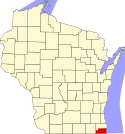
This is a locator map showing Kenosha County in Wisconsin. For more information, see Commons:United States county locator maps.
This is a locator map showing Adams County in Wisconsin. For more information, see Commons:United States county locator maps.
This is a locator map showing Waupaca County in Wisconsin. For more information, see Commons:United States county locator maps.
This is a locator map showing Eau Claire County in Wisconsin. For more information, see Commons:United States county locator maps.
This is a locator map showing Jackson County in Wisconsin. For more information, see Commons:United States county locator maps.
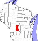
This is a locator map showing Wood County in Wisconsin. For more information, see Commons:United States county locator maps.
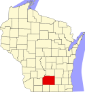
This is a locator map showing Columbia County in Wisconsin. For more information, see Commons:United States county locator maps.
Locator Map of Wisconsin, United States
This is a locator map showing Langlade County in Wisconsin. For more information, see Commons:United States county locator maps.
This is a locator map showing Juneau County in Wisconsin. For more information, see Commons:United States county locator maps.
This is a locator map showing Lafayette County in Wisconsin. For more information, see Commons:United States county locator maps.
This is a locator map showing Racine County in Wisconsin. For more information, see Commons:United States county locator maps.
This is a locator map showing Dane County in Wisconsin. For more information, see Commons:United States county locator maps.
This is a locator map showing Jefferson County in Wisconsin. For more information, see Commons:United States county locator maps.
This is a locator map showing Outagamie County in Wisconsin. For more information, see Commons:United States county locator maps.
This is a locator map showing Kewaunee County in Wisconsin. For more information, see Commons:United States county locator maps.
This is a locator map showing Marinette County in Wisconsin. For more information, see Commons:United States county locator maps.
This is a locator map showing Dunn County in Wisconsin. For more information, see Commons:United States county locator maps.
This is a locator map showing Trempealeau County in Wisconsin. For more information, see Commons:United States county locator maps.
This is a locator map showing Marquette County in Wisconsin. For more information, see Commons:United States county locator maps.
This is a locator map showing Saint Croix County in Wisconsin. For more information, see Commons:United States county locator maps.
This is a locator map showing Iowa County in Wisconsin. For more information, see Commons:United States county locator maps.
This is a locator map showing Waushara County in Wisconsin. For more information, see Commons:United States county locator maps.
This is a locator map showing Manitowoc County in Wisconsin. For more information, see Commons:United States county locator maps.
This is a locator map showing Price County in Wisconsin. For more information, see Commons:United States county locator maps.
This is a locator map showing Buffalo County in Wisconsin. For more information, see Commons:United States county locator maps.
This is a locator map showing Menominee County in Wisconsin. For more information, see Commons:United States county locator maps.
This is a locator map showing Oneida County in Wisconsin. For more information, see Commons:United States county locator maps.
This is a locator map showing Green County in Wisconsin. For more information, see Commons:United States county locator maps.
This is a locator map showing Florence County in Wisconsin. For more information, see Commons:United States county locator maps.
This is a locator map showing Vernon County in Wisconsin. For more information, see Commons:United States county locator maps.
This is a locator map showing Pepin County in Wisconsin. For more information, see Commons:United States county locator maps.
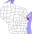
Locator map showing Door County (red) — in northeastern Wisconsin.
- Credits
- For more information, see Commons:United States county locator maps.
This is a locator map showing Green Lake County in Wisconsin. For more information, see Commons:United States county locator maps.
This is a locator map showing La Crosse County in Wisconsin. For more information, see Commons:United States county locator maps.
This is a locator map showing Waukesha County in Wisconsin. For more information, see Commons:United States county locator maps.
This is a locator map showing Sheboygan County in Wisconsin. For more information, see Commons:United States county locator maps.
This is a locator map showing Washburn County in Wisconsin. For more information, see Commons:United States county locator maps.
This is a locator map showing Richland County in Wisconsin. For more information, see Commons:United States county locator maps.
This is a locator map showing Dodge County in Wisconsin. For more information, see Commons:United States county locator maps.
This is a locator map showing Ozaukee County in Wisconsin. For more information, see Commons:United States county locator maps.
This is a locator map showing Douglas County in Wisconsin. For more information, see Commons:United States county locator maps.
This is a locator map showing Ashland County in Wisconsin. For more information, see Commons:United States county locator maps.
This is a locator map showing Winnebago County in Wisconsin. For more information, see Commons:United States county locator maps.
This is a locator map showing Chippewa County in Wisconsin. For more information, see Commons:United States county locator maps.
This is a locator map showing Pierce County in Wisconsin. For more information, see Commons:United States county locator maps.
This is a locator map showing Grant County in Wisconsin. For more information, see Commons:United States county locator maps.
This is a locator map showing Rusk County in Wisconsin. For more information, see Commons:United States county locator maps.
This is a locator map showing Portage County in Wisconsin. For more information, see Commons:United States county locator maps.
Locator map showing Marathon County — in Wisconsin.
- For more information, see Commons:United States county locator maps.
This is a locator map showing Lincoln County in Wisconsin. For more information, see Commons:United States county locator maps.
This is a locator map showing Milwaukee County in Wisconsin. For more information, see Commons:United States county locator maps.
This is a locator map showing Fond du Lac County in Wisconsin. For more information, see Commons:United States county locator maps.
This is a locator map showing Iron County in Wisconsin. For more information, see Commons:United States county locator maps.
This is a locator map showing Bayfield County in Wisconsin. For more information, see Commons:United States county locator maps.
This is a locator map showing Washington County in Wisconsin. For more information, see Commons:United States county locator maps.
This is a locator map showing Oconto County in Wisconsin. For more information, see Commons:United States county locator maps.
This is a locator map showing Brown County in Wisconsin. For more information, see Commons:United States county locator maps.
This is a locator map showing Sauk County in Wisconsin. For more information, see Commons:United States county locator maps.
This is a locator map showing Walworth County in Wisconsin. For more information, see Commons:United States county locator maps.
This is a locator map showing Sawyer County in Wisconsin. For more information, see Commons:United States county locator maps.
This is a locator map showing Forest County in Wisconsin. For more information, see Commons:United States county locator maps.
This is a locator map showing Taylor County in Wisconsin. For more information, see Commons:United States county locator maps.


