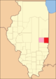
Edgar County
![Das Edgar County Courthouse, gelistet im NRHP Nr. 81000221[1]](/Media/Datei:EdgarCtyILCourthouse.jpg) Das Edgar County Courthouse, gelistet im NRHP Nr. 81000221[1] | |
| Verwaltung | |
|---|---|
| US-Bundesstaat: | Illinois |
| Verwaltungssitz: | Paris |
| Adresse des Verwaltungssitzes: | County Courthouse 115 West Court Street Paris, IL 61944-1739 |
| Gründung: | 3. Januar 1823 |
| Gebildet aus: | Clark County |
| Vorwahl: | 001 217 |
| Demographie | |
| Einwohner: | 16.866 (Stand: 2020) |
| Bevölkerungsdichte: | 10,44 Einwohner/km2 |
| Geographie | |
| Fläche gesamt: | 1617 km² |
| Wasserfläche: | 2 km² |
| Karte | |
 | |
| Website: edgarcountyillinois.com | |
Das Edgar County[2] ist ein County im US-amerikanischen Bundesstaat Illinois. Im Jahr 2010 hatte das County 18.576 Einwohner und eine Bevölkerungsdichte von 11,5 Einwohnern pro Quadratkilometer.[3] Der Verwaltungssitz (County Seat) ist Paris.[4]
Geografie
Das County liegt im Osten von Illinois an der Grenze zu Indiana. Es hat eine Fläche von 1617 Quadratkilometern, wovon zwei Quadratkilometer Wasserflächen sind. An das Edgar County grenzen folgende Nachbarcountys:
| Champaign County | Vermilion County | Vermillion County (Indiana) |
| Douglas County Coles County | .svg) | |
| Clark County | Vigo County (Indiana) |
Flüsse im County
- Bonwell Branch
- Catfish Creek
- East Fork
- Hickory Grove Creek
- Hughes Drain
- Lick Run
- McCalls Branch
- Shiloh Number 2 Drain
- Snake Creek
Geschichte
Das Edgar County wurde 1823 aus Teilen des Clark Countys gebildet. Benannt wurde es nach John Edgar, einem gebürtigen Iren, der als Kapitän der Royal Navy diente und im Amerikanischen Unabhängigkeitskrieg kämpfte.
Territoriale Entwicklung
![Bei Gründung im Jahr 1823[5]](//upload.wikimedia.org/wikipedia/commons/thumb/f/f3/Edgar_County_Illinois_1823.png/80px-Edgar_County_Illinois_1823.png)
Bei Gründung im Jahr 1823[5]

Zwischen 1825 und 1826
Zwischen 1826 und 1830

Seit 1830
Demografische Daten
| Bevölkerungsentwicklung | |||
|---|---|---|---|
| Census | Einwohner | ± rel. | |
| 1830 | 4071 | — | |
| 1840 | 8225 | 102 % | |
| 1850 | 10.692 | 30 % | |
| 1860 | 16.925 | 58,3 % | |
| 1870 | 21.450 | 26,7 % | |
| 1880 | 25.499 | 18,9 % | |
| 1890 | 26.787 | 5,1 % | |
| 1900 | 28.273 | 5,5 % | |
| 1910 | 27.336 | −3,3 % | |
| 1920 | 25.769 | −5,7 % | |
| 1930 | 24.966 | −3,1 % | |
| 1940 | 24.430 | −2,1 % | |
| 1950 | 23.407 | −4,2 % | |
| 1960 | 22.550 | −3,7 % | |
| 1970 | 21.591 | −4,3 % | |
| 1980 | 21.725 | 0,6 % | |
| 1990 | 19.595 | −9,8 % | |
| 2000 | 19.704 | 0,6 % | |
| 2010 | 18.576 | −5,7 % | |
| 2020 | 16.866 | −9,2 % | |
| Vor 1900[6] 1900–1990[7] 2000[4] 2010[3] | |||
Nach der Volkszählung im Jahr 2010 lebten im Edgar County 18.576 Menschen in 7877 Haushalten. Die Bevölkerungsdichte betrug 11,5 Einwohner pro Quadratkilometer. In den 7877 Haushalten lebten statistisch je 2,32 Personen.
Ethnisch betrachtet setzte sich die Bevölkerung zusammen aus 98,3 Prozent Weißen, 0,6 Prozent Afroamerikanern, 0,2 Prozent amerikanischen Ureinwohnern, 0,2 Prozent Asiaten sowie aus anderen ethnischen Gruppen; 0,7 Prozent stammten von zwei oder mehr Ethnien ab. Unabhängig von der ethnischen Zugehörigkeit waren 1,2 Prozent der Bevölkerung spanischer oder lateinamerikanischer Abstammung.
22,0 Prozent der Bevölkerung waren unter 18 Jahre alt, 59,3 Prozent waren zwischen 18 und 64 und 18,7 Prozent waren 65 Jahre oder älter. 51,5 Prozent der Bevölkerung war weiblich.
Das jährliche Durchschnittseinkommen eines Haushalts lag bei 39.904 USD. Das Pro-Kopf-Einkommen betrug 22.175 USD. 13,5 Prozent der Einwohner lebten unterhalb der Armutsgrenze.[3]
Ortschaften im Edgar County
- Chrisman
- Paris
|
|
|
|
|
|
|
1 – teilweise im Clark County
Gliederung
Das Edgar County ist in 15 Townships eingeteilt[8]:
|
|
|
Siehe auch
Einzelnachweise
- ↑ Auszug aus dem National Register of Historic Places. Abgerufen am 13. März 2011
- ↑ GNIS-ID: 424224. Abgerufen am 22. Februar 2011 (englisch).
- ↑ a b c U.S. Census Buero, State & County QuickFacts – Edgar County, IL (Memento vom 6. Juni 2011 im Internet Archive)
- ↑ a b National Association of Counties, abgerufen am 29. November 2012
- ↑ Jesse White: Origin and Evolution of Illinois Counties (PDF; 5,3 MB), abgerufen am 29. November 2012
- ↑ U.S. Census Bureau – Census of Population and Housing, abgerufen am 15. März 2011
- ↑ Auszug aus Census.gov, abgerufen am 15. Februar 2011
- ↑ Overview of Edgar County, Illinois (County). In: statisticalatlas.com. Abgerufen am 12. Juli 2018.
Weblinks
Liste der Countys in Illinois
Adams | Alexander | Bond | Boone | Brown | Bureau | Calhoun | Carroll | Cass | Champaign | Christian | Clark | Clay | Clinton | Coles | Cook | Crawford | Cumberland | DeKalb | DeWitt | Douglas | DuPage | Edgar | Edwards | Effingham | Fayette | Ford | Franklin | Fulton | Gallatin | Greene | Grundy | Hamilton | Hancock | Hardin | Henderson | Henry | Iroquois | Jackson | Jasper | Jefferson | Jersey | Jo Daviess | Johnson | Kane | Kankakee | Kendall | Knox | LaSalle | Lake | Lawrence | Lee | Livingston | Logan | Macon | Macoupin | Madison | Marion | Marshall | Mason | Massac | McDonough | McHenry | McLean | Menard | Mercer | Monroe | Montgomery | Morgan | Moultrie | Ogle | Peoria | Perry | Piatt | Pike | Pope | Pulaski | Putnam | Randolph | Richland | Rock Island | Saline | Sangamon | Schuyler | Scott | Shelby | St. Clair | Stark | Stephenson | Tazewell | Union | Vermilion | Wabash | Warren | Washington | Wayne | White | Whiteside | Will | Williamson | Winnebago | Woodford
Koordinaten: 39° 41′ N, 87° 45′ W
Auf dieser Seite verwendete Medien

Locator Map of Edgar County, Illinois, 1830.
Based on: Illinois Secretary of State. Origin and Evolution of Illinois Counties. March 2010. p. 50. http://www.cyberdriveillinois.com/publications/pdf_publications/ipub15.pdf
Edgar County Illinois


Locator Map of Edgar County, Illinois, 1826-1830.
Based on: Illinois Secretary of State. Origin and Evolution of Illinois Counties. March 2010. p. 48. http://www.cyberdriveillinois.com/publications/pdf_publications/ipub15.pdf
Locator Map of Edgar County, Illinois, 1823-1825.
Based on: Illinois Secretary of State. Origin and Evolution of Illinois Counties. 2010. p. 8, 42. http://www.cyberdriveillinois.com/publications/pdf_publications/ipub15.pdf
Locator Map of Edgar County, Illinois, 1825-1826.
Based on: Illinois Secretary of State. Origin and Evolution of Illinois Counties. March 2010. p. 46. http://www.cyberdriveillinois.com/publications/pdf_publications/ipub15.pdfAutor/Urheber: Robert C. Pusateri, Lizenz: CC BY 2.5
The Edgar County Courthouse, Paris, Illinois, USA.
This is a locator map showing Edgar County in Illinois. For more information, see Commons:United States county locator maps.